Equipment & Software for Geophysical Surveys: Design, Manufacture, Support, Supply
Marine Longitudinal Gradiometer MariMag LG
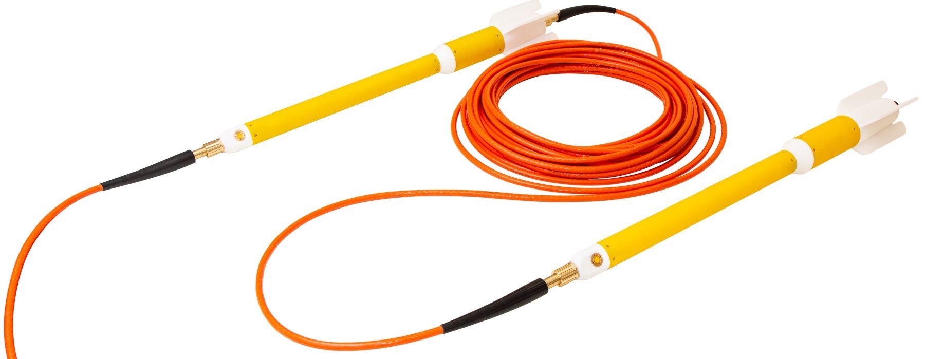
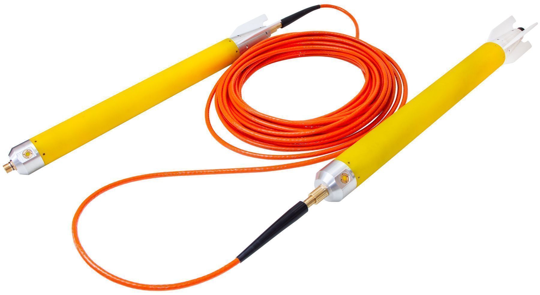
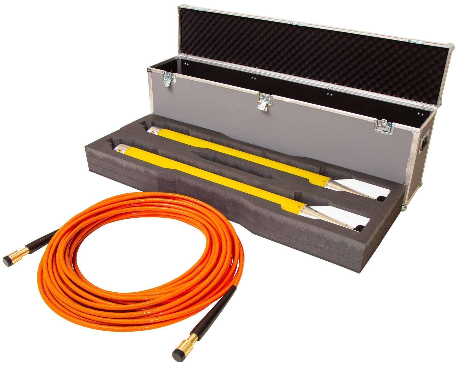
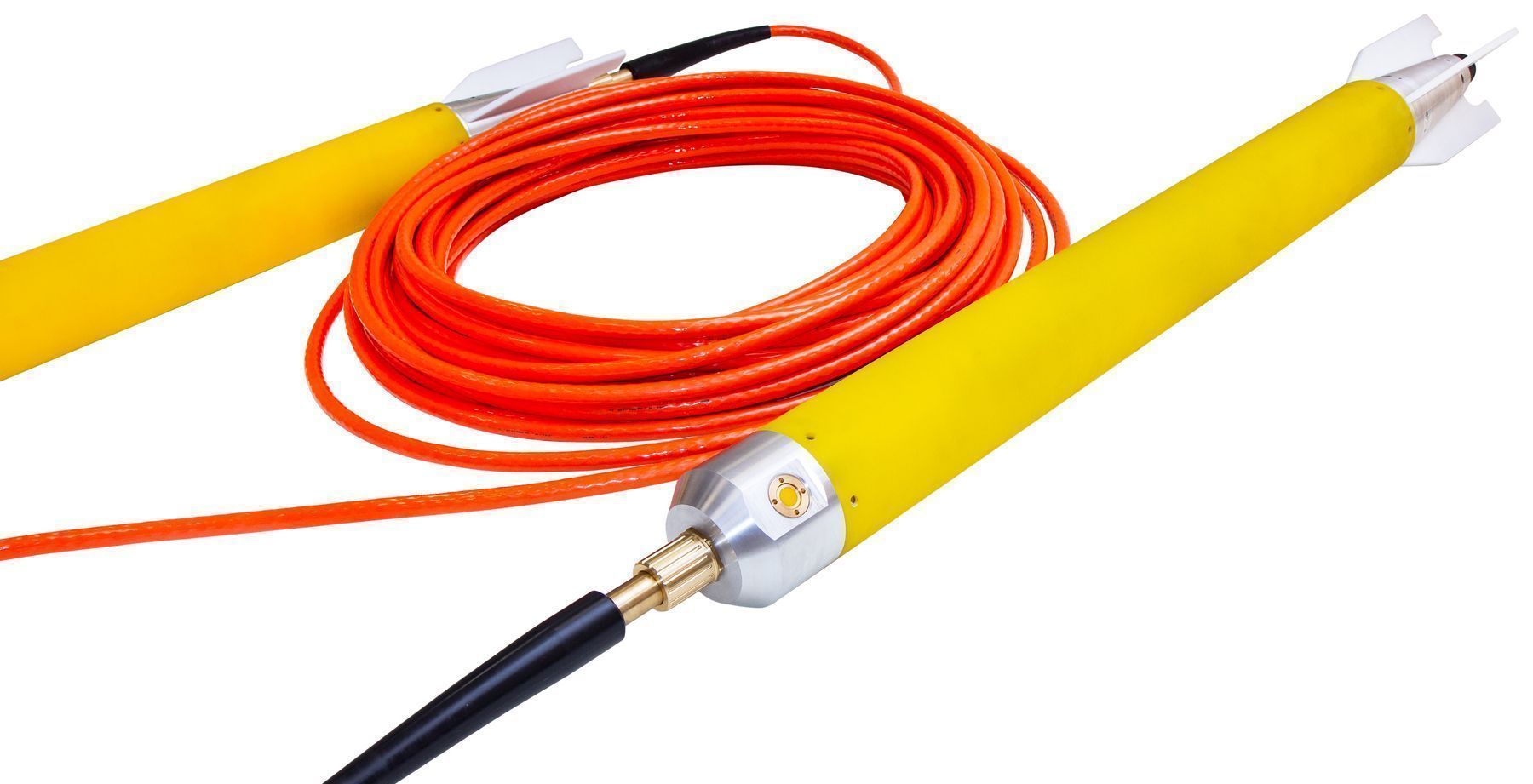
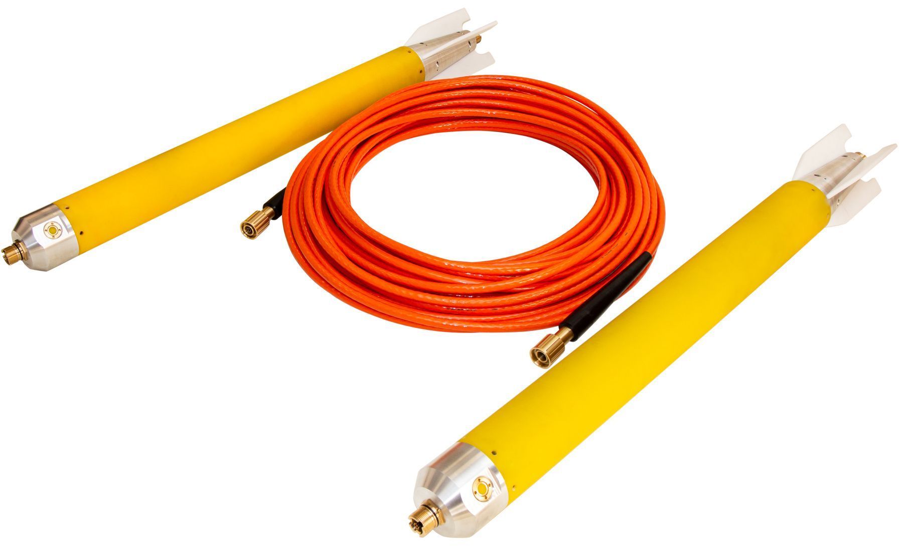
MariMag LG is a modern marine longitudinal gradiometer operating on Overhauser effect designed to perform geophysical, geotechnical and exploration works both in shallow and deep water. The device allows to measure the magnetic field gradient with high accuracy using two independent sensors. Each gradiometer gondola can be used as a separate towed magnetometer. Gradiometer consists of two magnetometer-gondolas and an inter-gondola cable of any length. Long inter-gondola sections (greater than 100 m) are suitable for regional and geological research, medium ones (from 10 to 100 m) - for solution of engineering problems and searching for large artificial objects. Sections less than 10 m are commonly used for seabed surveys, UXO detection, archaeological surveys and pipeline tracing.
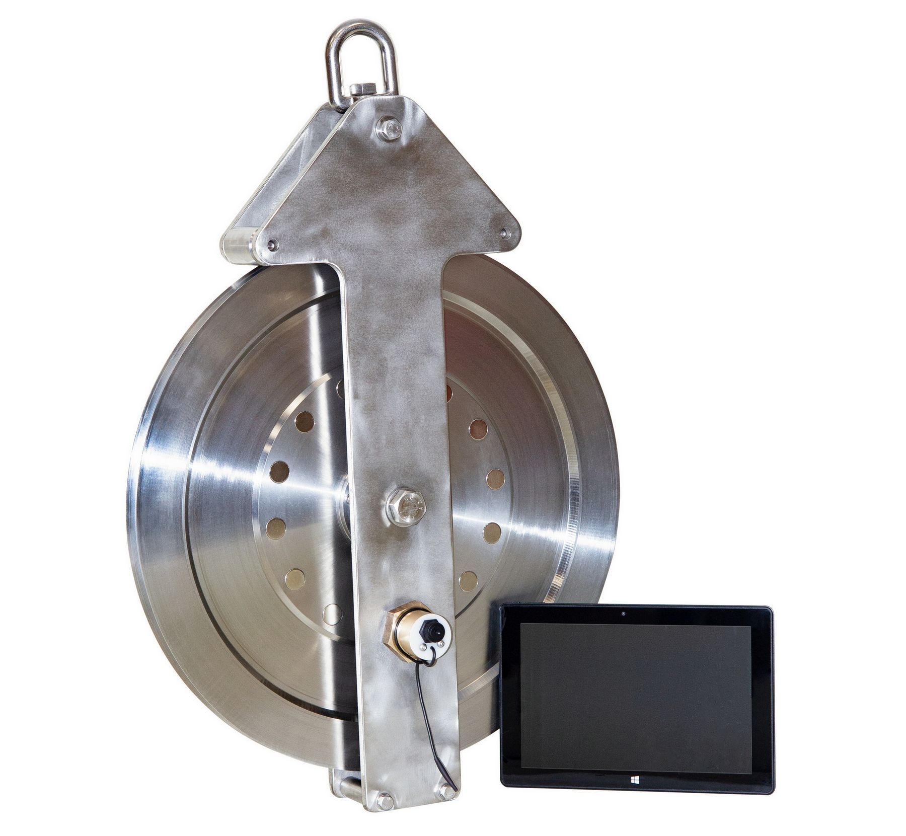
A built-in pressure sensor, digital compass and accelerometer allow real-time gondola position calculation, while an optional altimeter provides towing depth in term of distance above seabed. Three versions of gondola ensure safe towing of the device at depths up to 300, 1000 or 3000 m.
MariMag
Overhauser sensors used in MariMag LG do not require orientation during operation and are maintenance free for 10 years. The modular principle of MariMag makes it easy to assemble towed magnetometer-gradientometers of various configurations with an almost unlimited number of sensors.
Work without base stationWorking with transverse or longitudinal gradiometers allows to take into account variations in the magnetic field in real time, in contrast to standard hydromagnetic survey with base station, where variation is taken into account only during post-processing of data from the field magnetometer and magnetic base station.

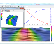
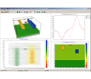
The software sets the device configuration and measurement parameters, displays the values of the modulus or magnetic field gradient, controls the operation of the device during the survey and visualizes its spatial position in real time. The module of survey design creates a network of observations with the option to download profiles in KML format or manually, plan the ship's route to a given profile and navigate along it, place marks and control points comments, as well as download and visualize maps in KML format, as a raster Google images or satellite imagery.
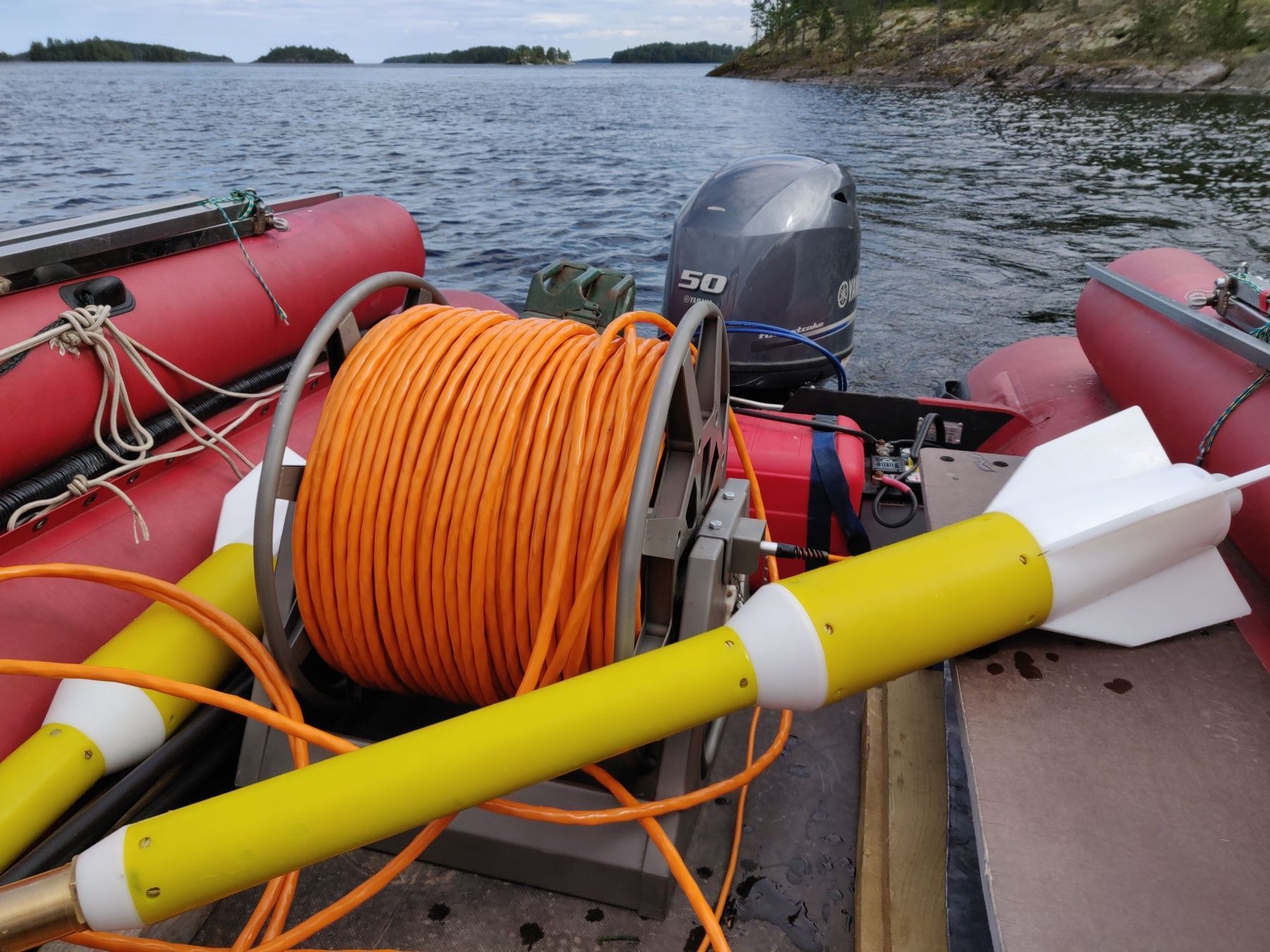
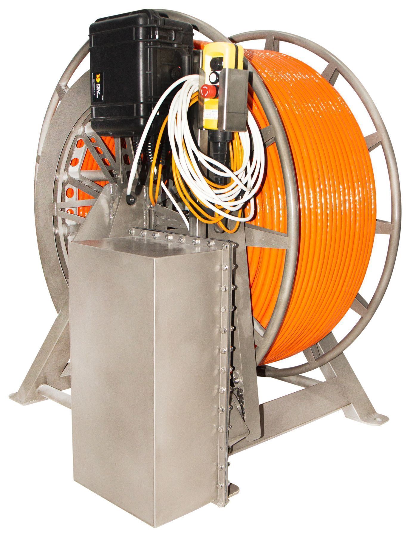
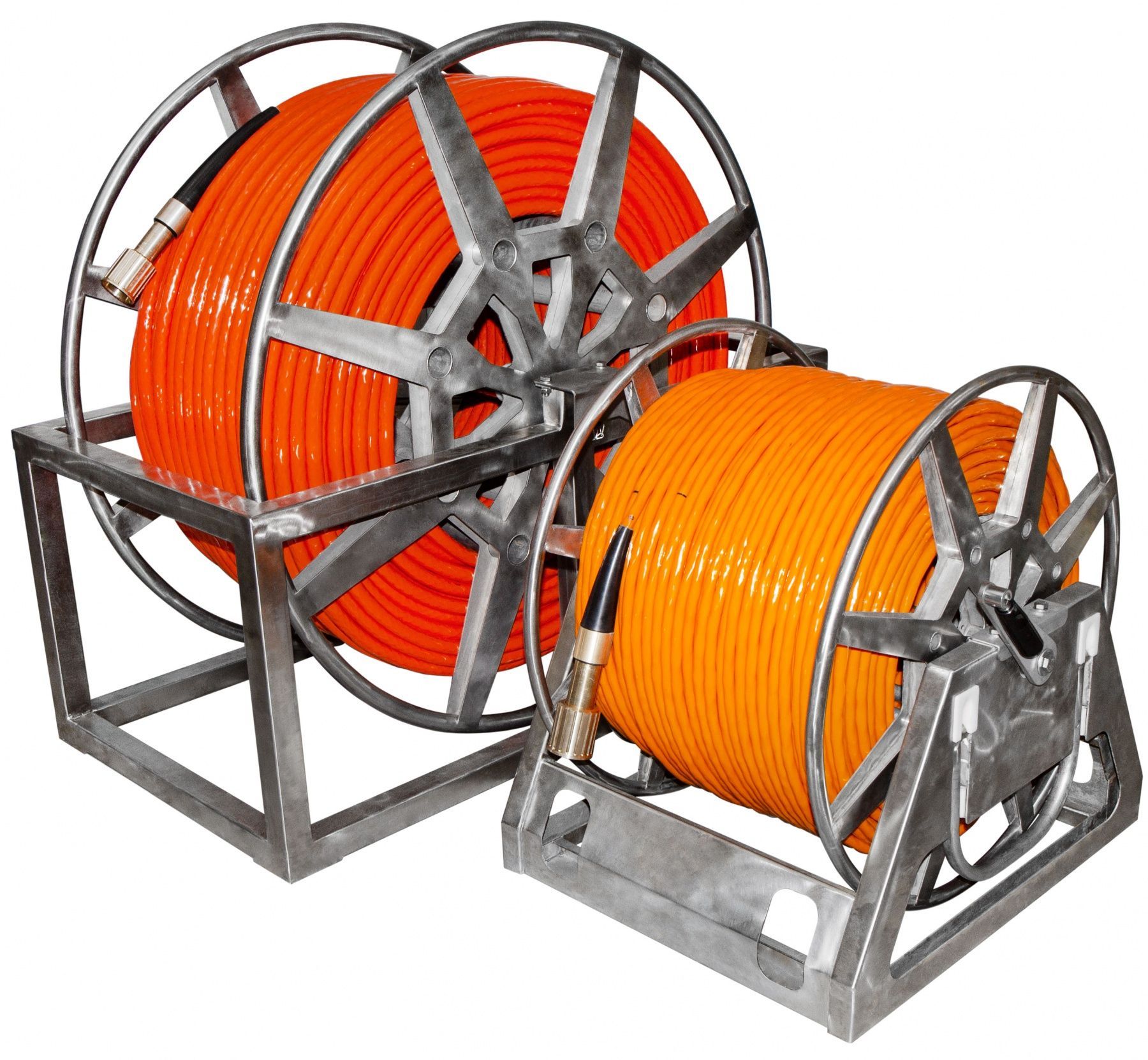
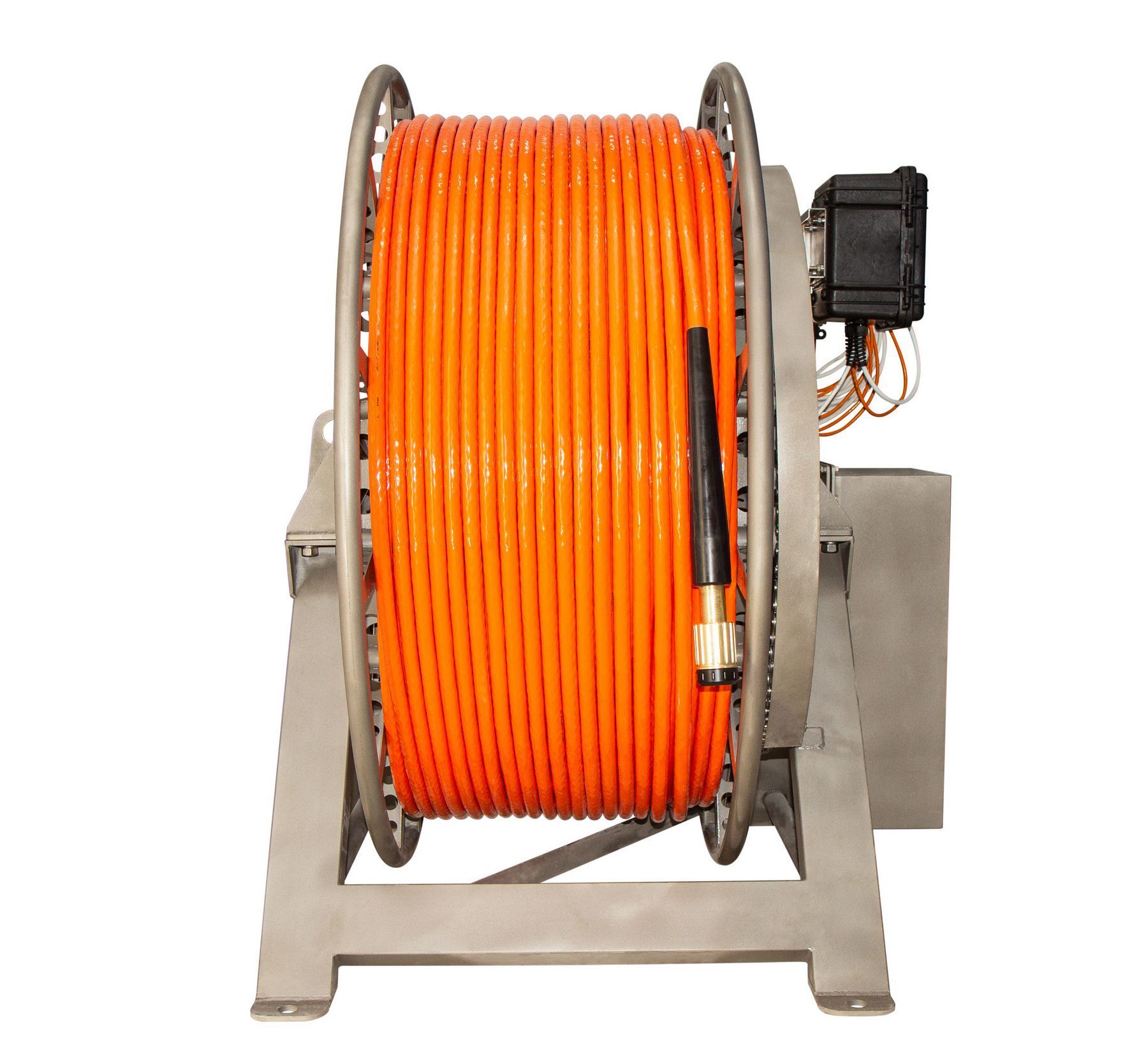
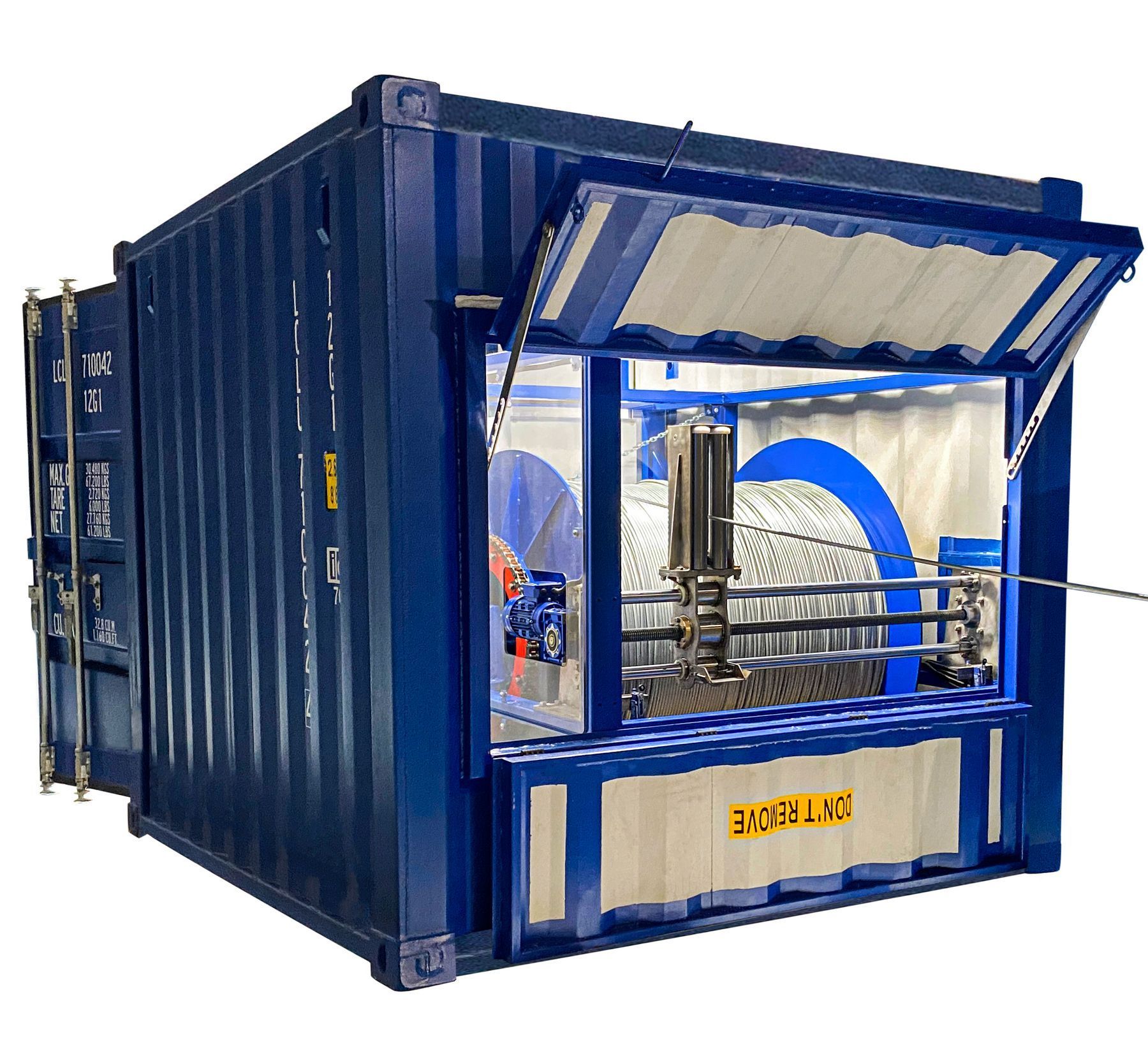
Cables, reels and winchesWe have thought of different use scenarios and have developed a sinking cable for hydromagnetic surveys, a floating cable for near-surface hydromagnetic surveys, and a steel cable for towed magnetometers or gradiometers. For the convenience of the device use, we offer reels with a slip-ring, winches with slip-ring and electric drive, high-speed deck winches with slip-ring, electric drive, cable layer and a cable counter.
- UXO detection
- Pipelines and cables detection and inspection
- Archaeological research
- Ecological research
- Engineering surveys
- Mineral exploration
- Exploration for oil and gas
- Regional exploration
- MariMag magnetometer – 2 pcs
- Weight – 2 pcs
- Inter-gondola cable – 1 pc
- Recorder with built-in GNSS – 1pc
- Power supply with charger – 1 pc
- Power cable – 1 pc
- 100 ÷ 240 VAC power supply – 1 pc
- Ethernet сable – 1 pc
- Deck cable (70m) – 1 pc
- Data acquisition, visualization & control software – 1 pc
- Shipping/storage case – 1 pc
We manufacture magnetometers and gradiometers in various configurations. For the correct technical specification for purchase or rental of equipment, contact us in any way indicated on the site. We can also help you with the processing and interpretation of the data, or you can do it yourself in ZondGM2d and ZondGM3d software.
|
Magnetometer |
|
|
Dynamic range |
18 000 to 120 000 nT |
|
Absolute accuracy |
0.1 nT |
|
Sensor sensitivity |
0.01 nT |
|
Counter sensitivity |
0.001 nT |
|
Resolution |
0.001 nT |
|
Heading Error |
0.1 nT (180°) |
|
Gradient tolerance |
30 000 nT/m |
|
Max sample rate |
5 Hz |
|
Interfaces |
Ethernet |
|
Power supply |
12 ÷ 30 VDC or 100 ÷ 240 VAC |
|
Weight in air |
11 kg |
|
Operation limitations |
|
|
Operation temperatures |
-20 ÷ +60°C |
|
Storage temperatures |
-40 ÷ +70°C |
|
Elevation |
3 000 m |
|
Depth |
300, 1 000 or 3 000 m |
|
Tow cable |
|
|
Breaking strength |
2 500 kg |
|
Outer diameter |
13 mm |
|
Weight in air |
125 g/m |
|
Weight in water |
46 g/m |
|
Floating cable |
|
|
Breaking strength |
2 500 kg |
|
Outer diameter |
20 mm |
|
Weight in air |
250 g/m |
|
Weight in water |
-20 g/m |