Equipment & Software for Geophysical Surveys: Design, Manufacture, Support, Supply
Overhauser drone magnetometer AeroSmartMag
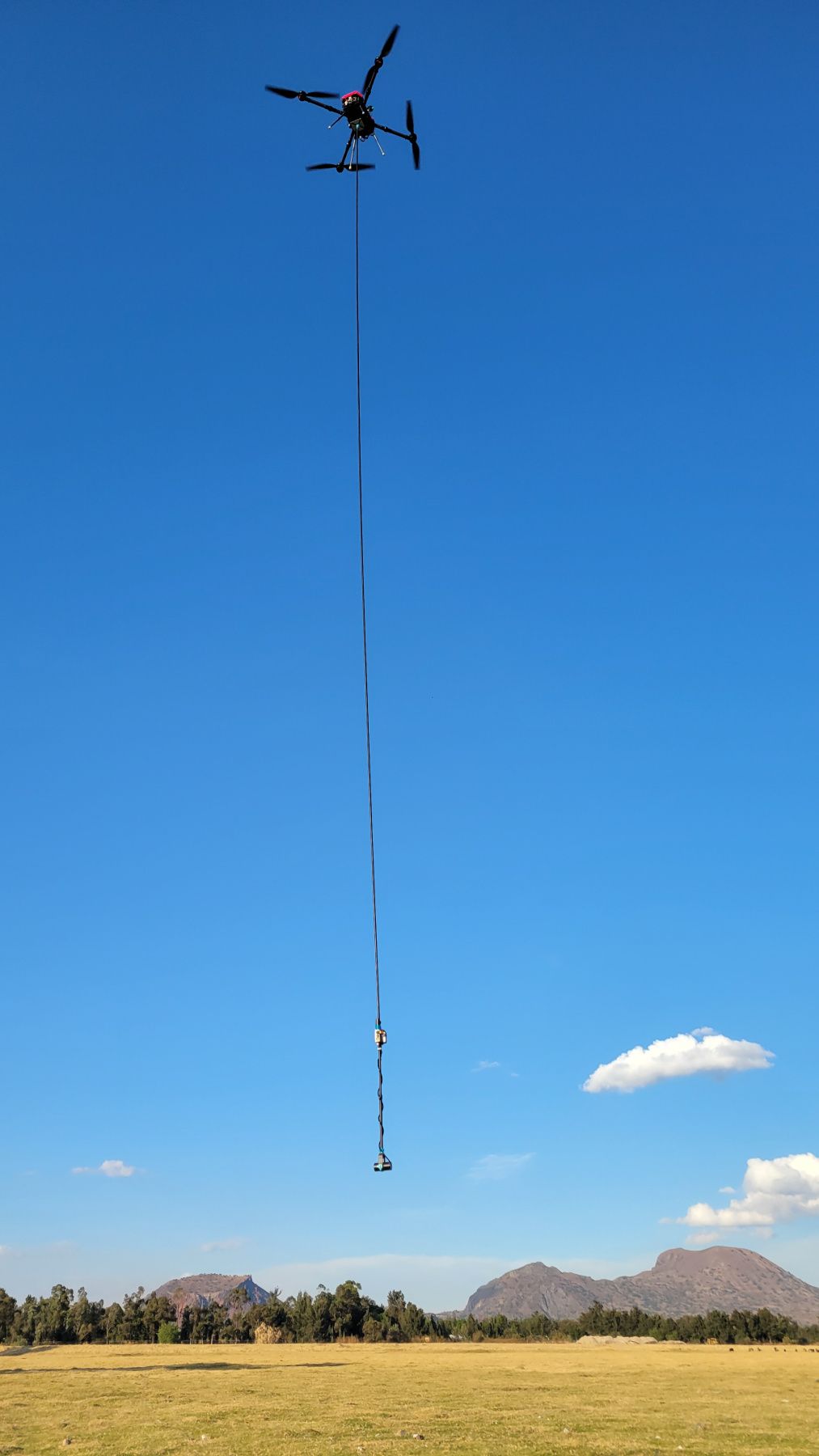
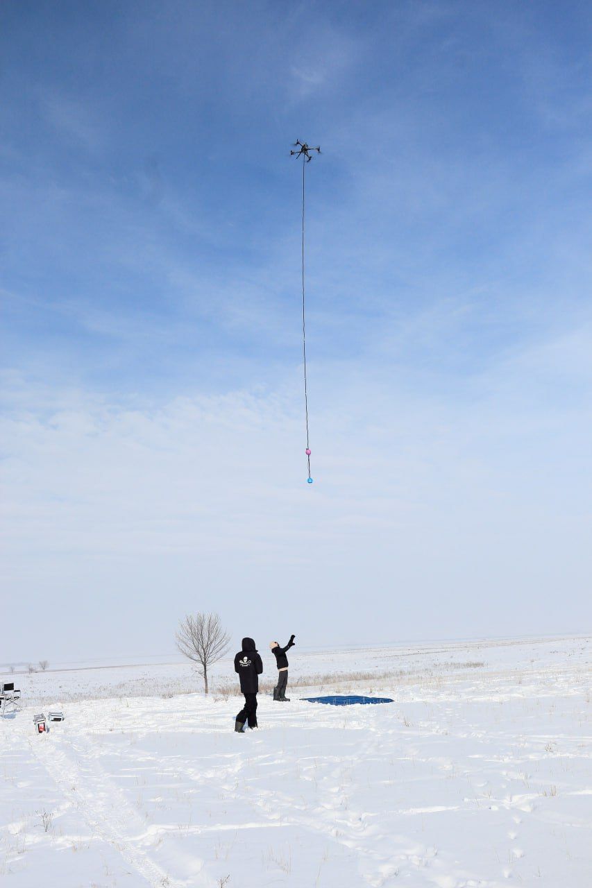
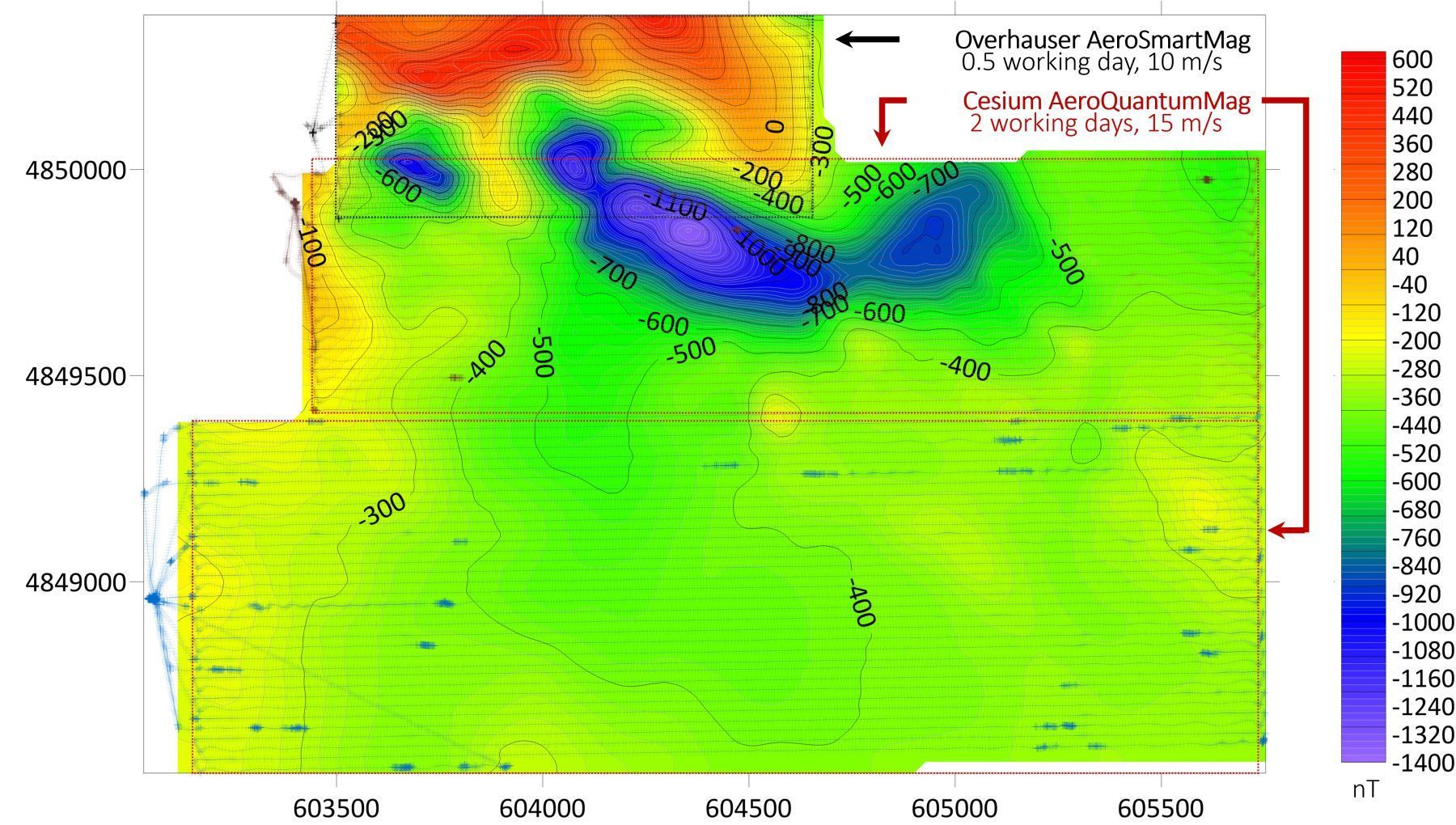
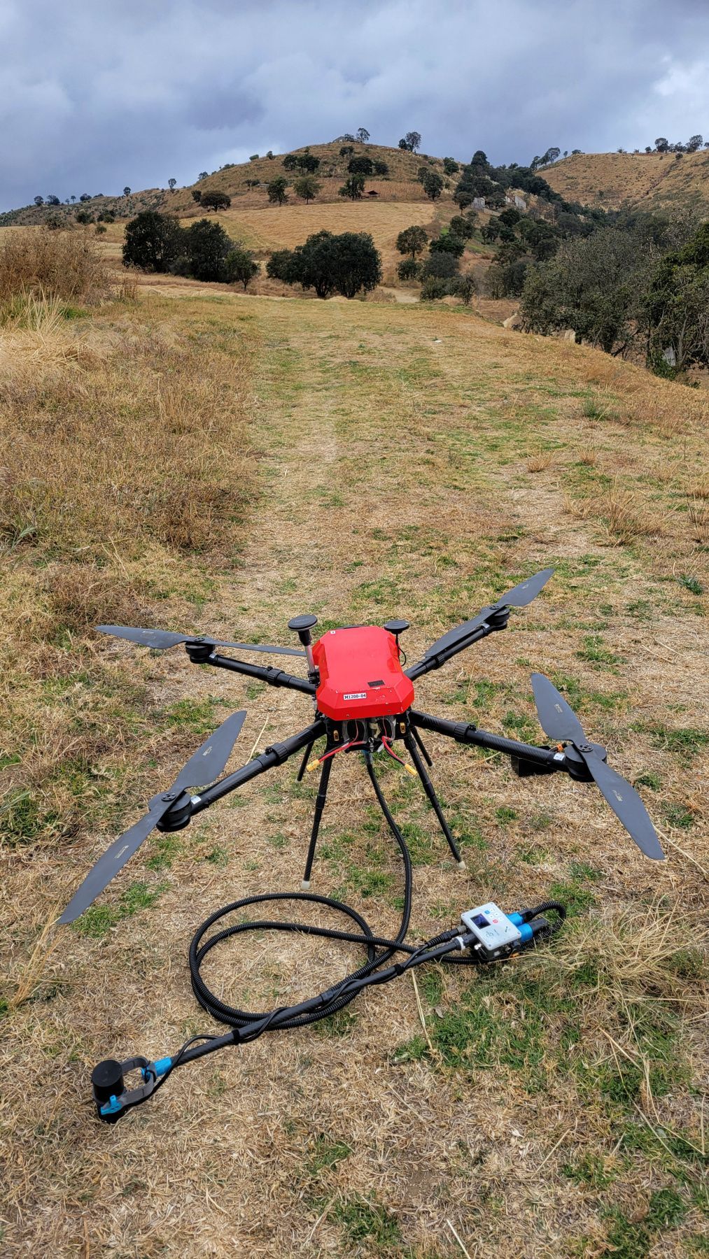
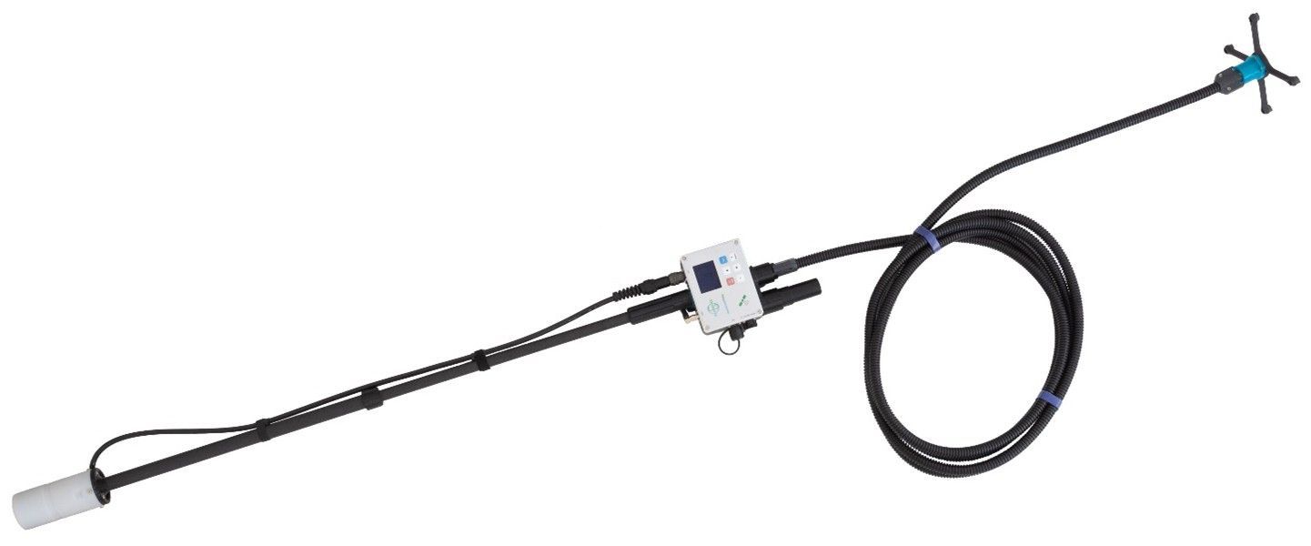
AeroSmartMag is an evolution of the SmartMag platform - the world's most advanced and portable magnetometer, based on Overhauser effect. We've lightened the sensor, developed a lighter frame, and achieved a fully assembled weight of less than 1.2 kg, battery included. Optimized design in combination with dedicated algorithms, aims to eliminate sway noise during flight. The Overhauser sensor does not require orientation or warm-up before flight. All this, combined with very low power consumption, makes AeroSmartMag the easiest-to-use drone magnetometer in the industry. Its affordable price positions AeroSmartMag as a revolutionary product.
Easy-to-use drone magnetometer
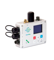
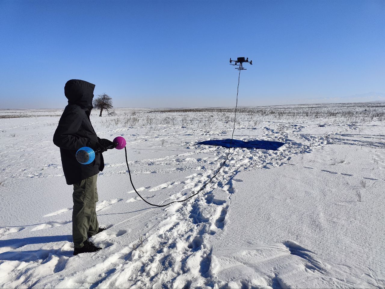
AeroSmartMag is equipped with very user friendly console – simply use the buttons to select the measurement parameters and press Start. After that, you don't need to do anything for up to 5 hours - just change the drone's batteries for each new flight. All measurements are saved on the built-in microSD card. Data is downloaded via USB to a PC or smartphone. The remote control is equipped with an OLED display (-40 ÷ +60 °C), a built-in multi-band GNSS receiver with the ability to collect RAW GNSS data and a backlit keyboard.
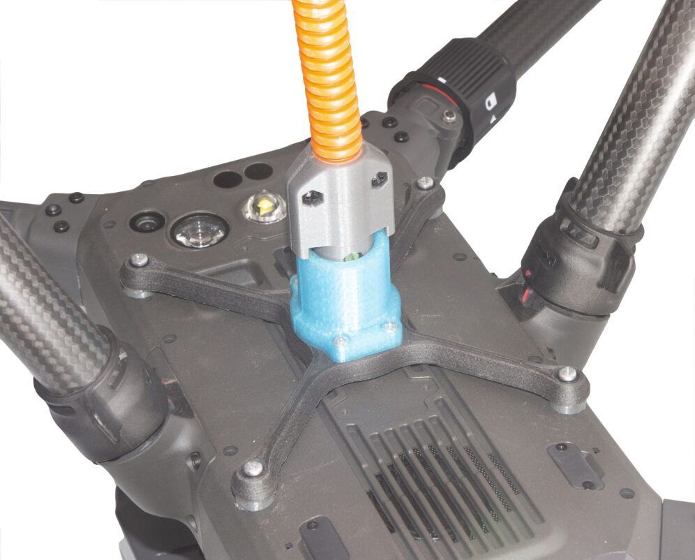
The foldable magnetometer frame reduces the device size during transportation, and also absorbs the shock and reduces damage if the drone falls. We use mostly 3D printed hardware parts, so if there is a possible failure off any part, we will send you models to print the required components on a nearby printer.
Power supply
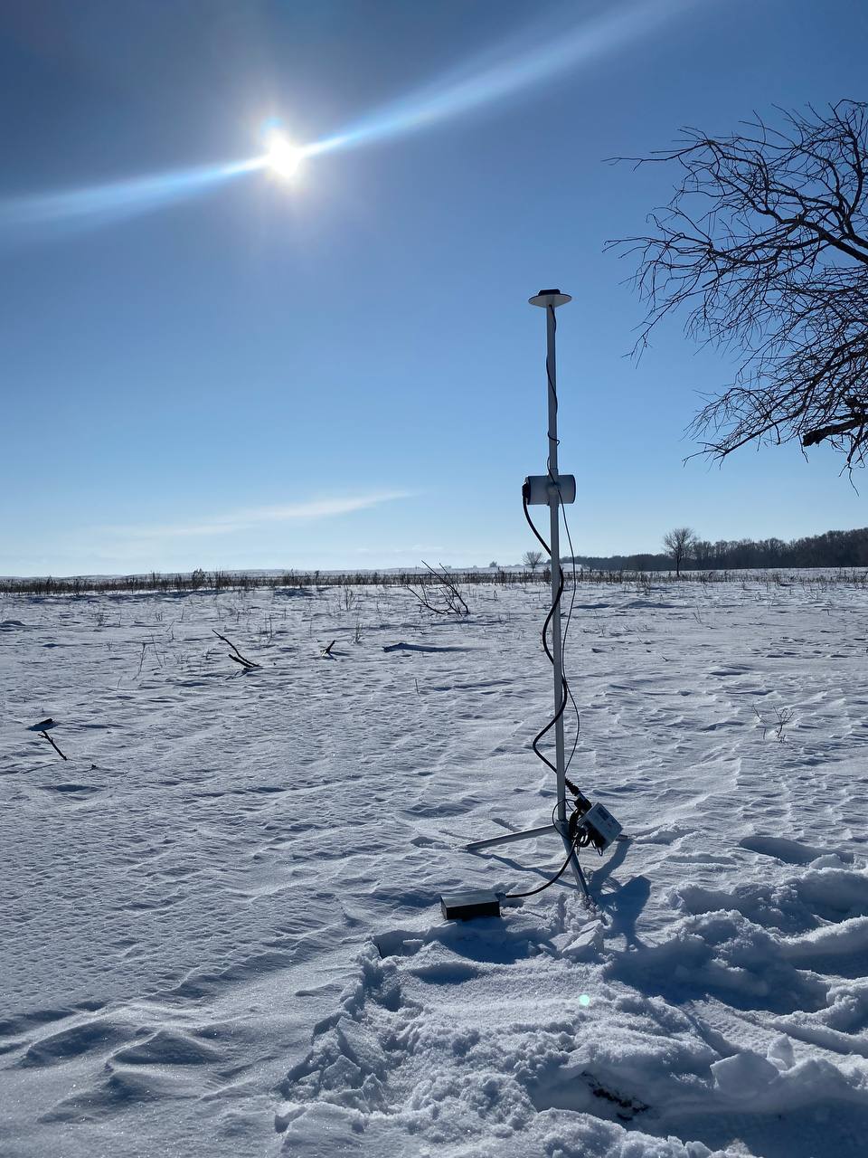
AeroSmartMag operates up to 5 hours of continuous measurements with very lightweight battery included. You can also connect a more powerful battery if you want to use the magnetometer as a base station or GNSS receiver.
Data format
User can create project folders that can be used to divide survey sites or data collection days. All measurements are saved in a TXT file in the project folder. The file from each magnetometer has a name containing the serial number of the console, the code of the measurement mode and the number of connected sensors. The files have a homogeneous structure, i.e. each measurement in the file is a line that contains all necessary information: UTC date and time, time zone, flight number or base name, measured field, estimated error, sensor serial number, latitude and longitude in decimal degrees, altitude, UTM coordinates with automatic zone and hemisphere selection, horizontal and vertical accuracy. Raw GNSS data is stored in a separate file with the same name.
Even if there are many operators working on a survey site at the same time, you will always be able to identify which instrument was used for each single measurement in the database.
Metrology and noise protection - a guarantee of high accuracy
Every AeroSmartMag is metrologically tested. We control the standard deviation of random error (noise), absolute accuracy and heading error.
The robust algorithms allow to perform measurements at high level of industrial noise, in a city environment, or right under/up high-voltage powerlines.
Built-in multi-band GNSS receiver with centimeter level accuracy
Time and coordinates are provided by the built-in multi-band GNSS receiver with PPK feature, which allows to achieve a centimeter level accuracy. AeroSmartMag also has GNSS receiver mode and can be used as a GNSS base, rover or tracker without mag sensor connected during any geophysical applications. Stored RAW GNSS data could be easily converted to RINEX format.
Reliability and warranty
Our R&D specialists have extensive experience in performing geophysical surveys. We are well aware that such equipment must be reliable, and the service must be fast and convenient. We give 3 years warranty on all our magnetometers, and our technical support will promptly answer any of your questions. Our Overhauser sensors have the longest in the World lifecycle of more than 10 years. If you are still working with outdated magnetometers - take advantage of our trade-in offer and protect your projects from potential problems.
- Fairings have a golf ball shape to optimize turbulent flow
- Keyboard with backlight
- Up to 5 hours of continuous operation with the battery included
- Could be used as a base station or a GNSS receiver with centimeter accuracy
- Drone magnetic survey with simultaneous recording of RAW GNSS data
- Base station with continuous measurements
- GNSS receiver mode with ability to collect RAW GNSS data for a centimeter level accuracy with base or rover modes
Application area
- Mineral exploration
- UXO detection
- Regional geological surveys
- Engineering surveys
- Pipeline mapping
- Archaeological studies
- Oil and gas exploration
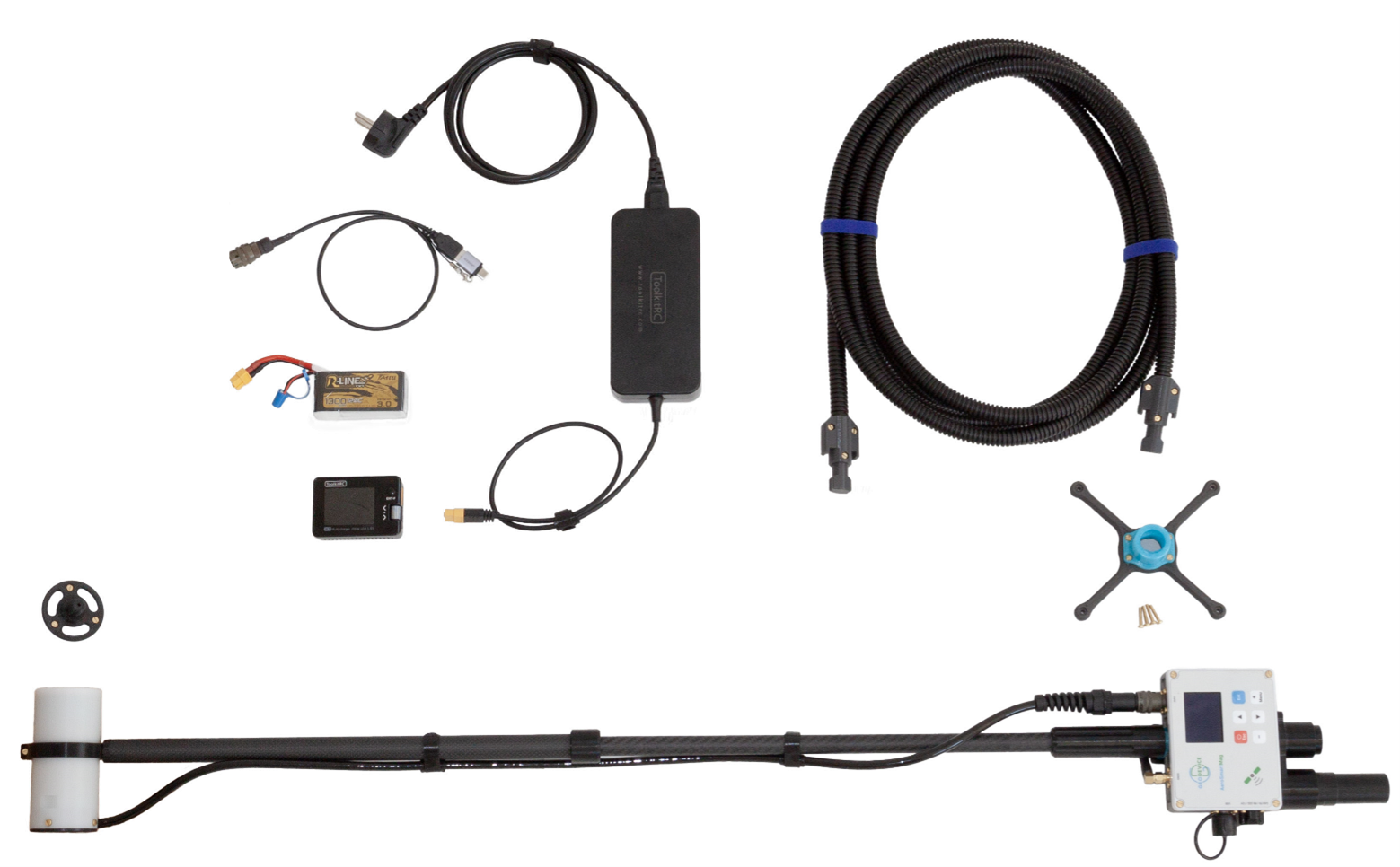
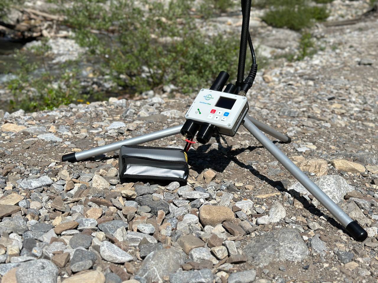
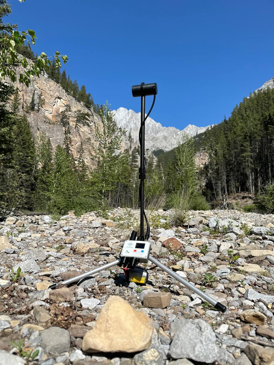
- AeroSmartMag console with built-in multi-band GNSS receiver
- Portable Overhauser sensor on carbon rod
- External helical GNSS antenna
- Suspension rope
- USB cable
- Transportation case
- LiPo 4S 14.8V 1300mAh battery (2 pcs.) with charger
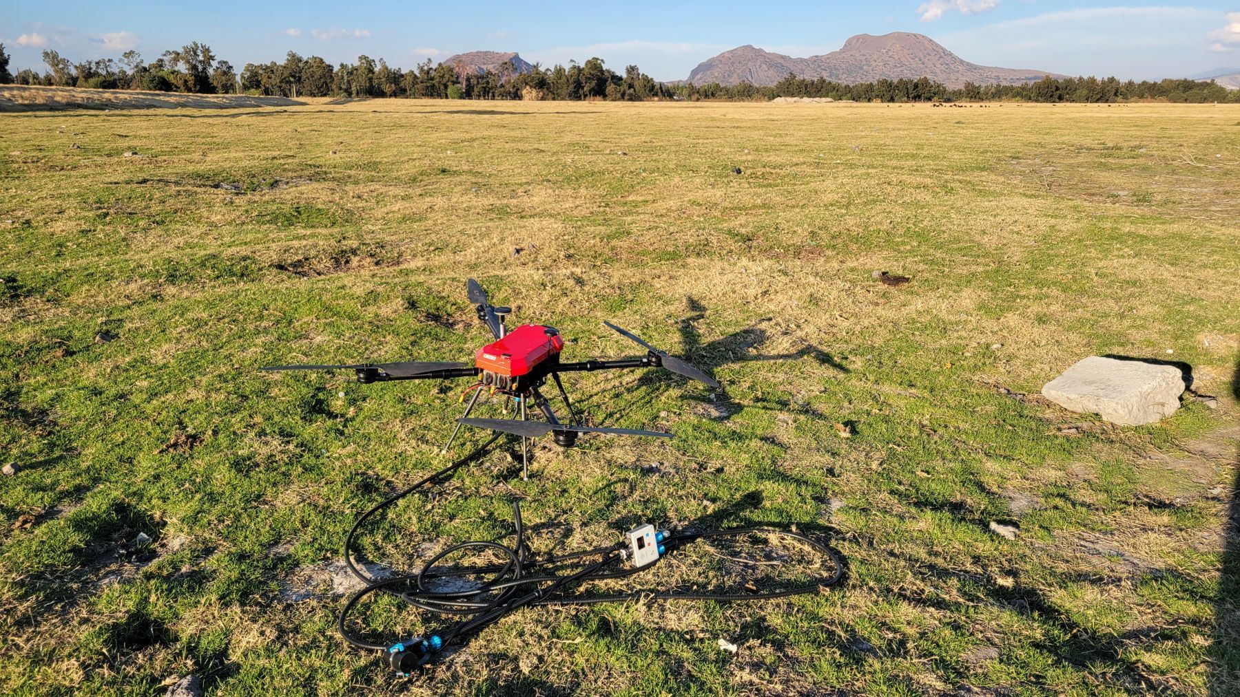
- Suspension bracket for DJI Matrice M300/M350/M400
- Suspension bracket for customer drone
- Non-magnetic tripod with bracket for base station mode
- Li-ion battery 14.8V/4Ah with charger for base station mode
|
Type |
Overhauser magnetometer |
|
Number of sensors |
1 |
|
Dynamic range |
20 000 to 120 000 nT |
|
Absolute accuracy |
0.1 nT |
|
Sensor sensitivity |
0.021 nT/√Hz rms |
|
Resolution |
0.001 nT |
|
Gradient tolerance |
30 000 nT/m |
|
Sample rates |
Drone mode: 0.2, 0.25, 0.5, 1 s |
|
Sensors stability |
> 10 years |
|
Additional sensors |
IMU, compass |
|
Interfaces |
built-in: USB, RS-232, CAN FD |
|
GNSS receiver |
built-in |
|
GNSS antenna |
external |
|
GNSS signals |
GPS L1C/A and L2C; GLONASS L1OF and L2OF; Galileo E1B/C and E5b; BeiDou B1I and B2I; QZSS L1C/A, L1S and L2C. SBAS: WAAS, EGNOS, MSAS, GAGAN. |
|
Connectors |
1 × CAN FD / RS232 / 12V, USB, external GNSS antenna, Overhauser sensor |
|
Display |
160 × 128, OLED |
|
Keypad |
6 buttons with backlight |
|
Built-in memory |
up to 32 Gb (microSD) |
|
Power supply |
9.5-21 VDC, LiPo 3S/4S, Li-ion 3S/4S, LiFePo4 4S, or lead-acid battery |
|
Operating temperature |
–40 to +60 °C |
|
Battery |
LiPo 4S 14.8V 1.3Ah |
|
Item weight |
1.2 kg – fully assembled with battery |